Modifications
htrdr is free software. Far from a simple credo,
the user is invited to study, modify and redistribute it
according to his own needs. This page lists some of these forks
developed by the htrdr community.
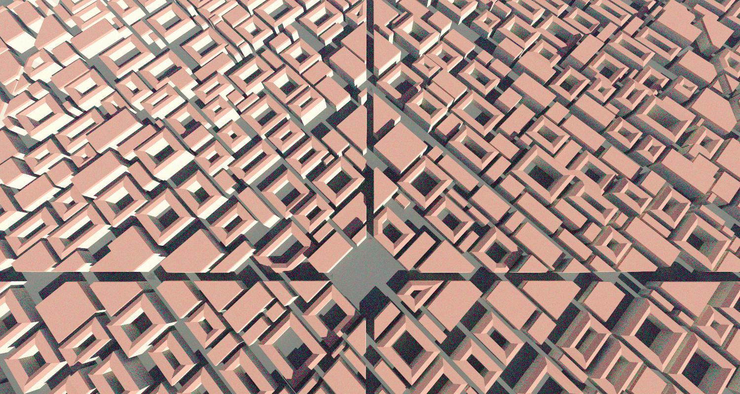
htrdr Urban

Fig. 1 - Rendering in the visible part of the solar spectrum of a
procedurally generated dense mid-rise city. The number of pixels is 1500x800,
the vertical field of view 70°, and the number of samples per pixel 200.
The htrdr Urban program is a fork of htrdr 0.6.1
that simulates radiative transfer in scenes composed of an atmospheric gas
mixture, clouds, and a ground with buildings and vegetation. In addition of
visible or infrared rendering of virtual scenes and calculation of
solar or infrared irradiation, htrdr Urban adds the
calculation of radiative flux density incident on or absorbed by a group
of triangles belonging to the ground geometry (e.g. building, walls, windows,
roofs, etc.) and humans. Visit the project repository
for more information about this modification (features, installation process,
use case, etc).
The following figures illustrate some of the results obtained with
htrdr Urban.
Fig. 2 - Solar radiation budget of infinitely-long street canyon
geometries with different aspect ratios (building height divided by street
width) simulated with htrdr-urban (MC) and the Town Energy Balance (TEB),
which calculates radiative exchange with the radiosity method. The
radiation budget consists of the reflected radiation (UP) and the radiation
absorbed by the roof (ABS_ROOF), walls (ABS_WALL), and road (ABS_ROAD). All
terms have been normalized with the downwelling solar radiation. The plane
area building density is 0.5. All surfaces have a Lambertian broadband
albedo of 0.5. (left) The downwelling solar radiation consists of only
direct radiation. (right) The downwelling solar radiation consists of
isotropic diffusive radiation.
Fig. 3 - (left) Spatial distribution (1 m resolution) of the
Mean Radiant Temperature (MRT) in a compact mid-rise urban district of
800 m x 800 m horizontal extent during the daytime. A
rendering of the district is shown in Fig. 1. The solar elevation angle
is 50° and the sky is clear. The sun is located in the west of the
district (it shines from left to right) leading to low MRT due to shading on
the right of the buildings and high MRT due to reflected solar radiation on
the left of the buildings. The temperature of all surfaces is 295 K. The
white colour depicts the built areas for which the outdoor MRT is not
defined. (right) Standard deviation of the MRT displayed in (left) calculated
by the Monte-Carlo method.
